
Файл:Carte generale de l'Empire Chinois et du Japon (1836).jpg

Үзлэгийн хэмжээ : 800 × 582 пиксел Бусад зургын нягтрал: 320 × 233 пиксел | 640 × 465 пиксел | 1,024 × 745 пиксел | 1,280 × 931 пиксел | 2,560 × 1,861 пиксел | 8,445 × 6,140 пиксел.
Эх файл (8,445 × 6,140 пиксел, файлын хэмжээ: 12.87 МБ, MIME төрөл: image/jpeg)
Товч агуулга
| Тайлбар |
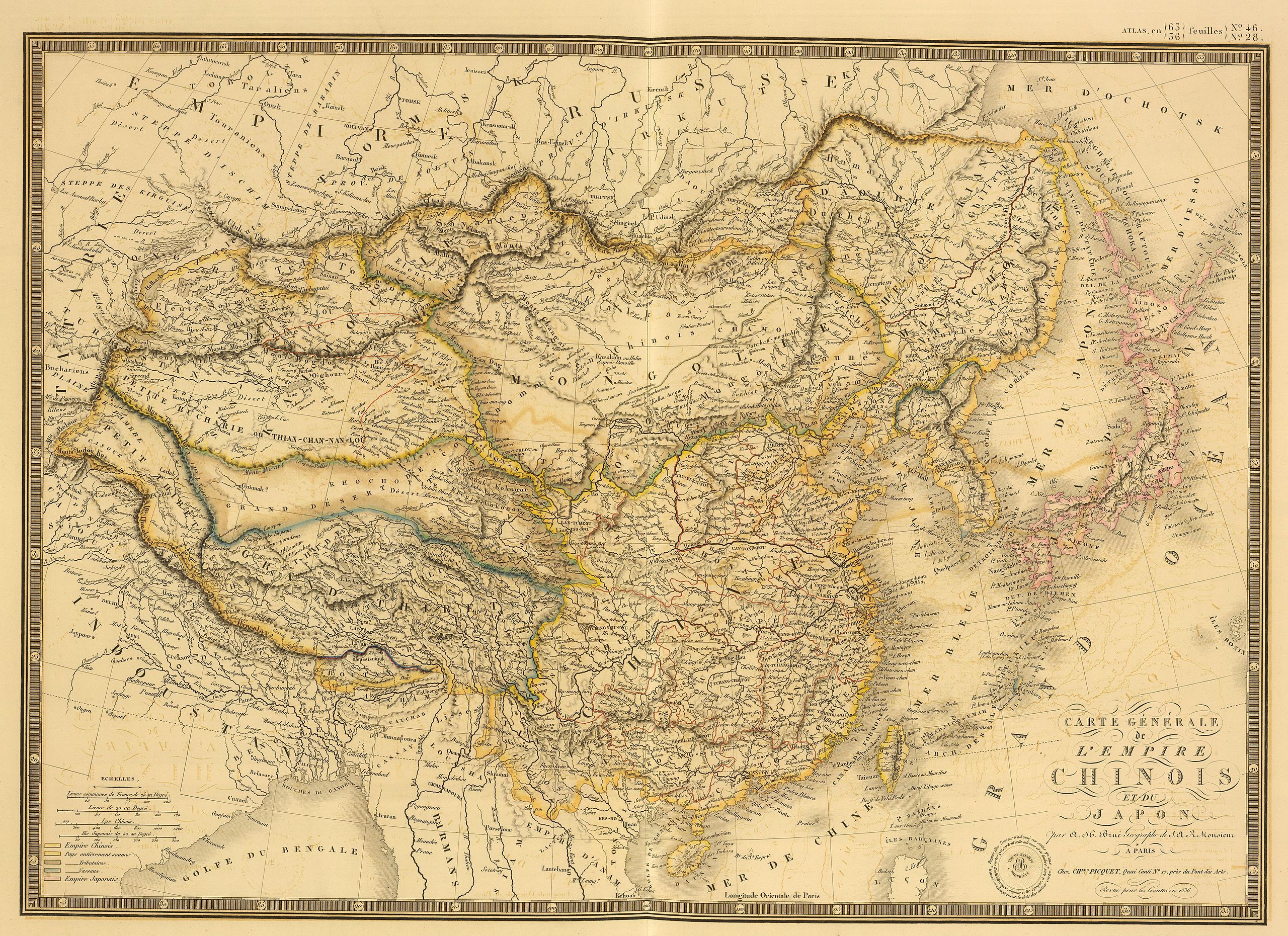
English: 1836 French map of China and Japan published by C. Picque in Paris. Note the lower course of the Yellow River prior to the 1850s floods. |
| Огноо | |
| Эх үүсвэр | Carte generale de l'Empire Chinois et du Japon par A.H. Brue, Geographe de S.A.R. Monsieur. A Paris, Chez Chles. Picquet, Quai Conti No. 17, pres du Pont des Arts. Revue pour les limites en 1836. |
| Зохиогч | Brue, Adrien Hubert, 1786-1832; Picquet, C. |
| Other versions |
|

.jpg)
Лиценз
This media file is in the public domain in the United States. This applies to U.S. works where the copyright has expired, often because its first publication occurred prior to January 1, 1929, and if not then due to lack of notice or renewal. See this page for further explanation.
|
 | |
 |
This image might not be in the public domain outside of the United States; this especially applies in the countries and areas that do not apply the rule of the shorter term for US works, such as Canada, Mainland China (not Hong Kong or Macao), Germany, Mexico, and Switzerland. The creator and year of publication are essential information and must be provided. See Wikipedia:Public domain and Wikipedia:Copyrights for more details.
|
| Annotations | This image is annotated: View the annotations at Commons |
Файлын түүх
Огноо/цаг дээр дарж тухайн үеийнх нь файлын байдлыг харна уу.
| Огноо/Цаг | Жижиг зураг | Хэмжээ | Хэрэглэгч | Тайлбар | |
|---|---|---|---|---|---|
| одоогийн | 09:20, 23 Есдүгээр сар 2011 | | 8,445 × 6,140 (12.87 МБ) | Benlisquare | {{Information |Description ={{en|1=1836 French map of China and Japan published by C. Picque in Paris.}} |Source =Carte generale de l'Empire Chinois et du Japon par A.H. Brue, Geographe de S.A.R. Monsieur. A Paris, Chez Chles. Picquet, Quai Con |
Холбоос
Дараахь хуудсууд уг файлтай холбогдсон байна:
Файлын хэрэглээ (бүх төсөл)
Дараах бусад вики энэ файлыг ашигладаг:
- en.wikipedia.org дахь хэрэглээ
- fr.wikipedia.org дахь хэрэглээ
- ru.wikipedia.org дахь хэрэглээ
.jpg)