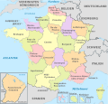
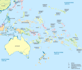
Файл:Netherlands (+BES). administrative divisions - de (3x zoom).svg
Page contents not supported in other languages.

Size of this PNG preview of this SVG file: 800 × 518 пиксел. Бусад зургын нягтрал: 320 × 207 пиксел | 640 × 414 пиксел | 1,024 × 663 пиксел | 1,280 × 828 пиксел | 2,560 × 1,657 пиксел | 822 × 532 пиксел.
Эх файл (SVG файл, 822 × 532 пиксэл, файлын хэмжээ: 4.5 МБ)
Энэ файл нь Wikimedia Commons-нх бөгөөд бусад төслүүд үүнийг хэрэглэх боломжтой. Доор файлын тайлбарын хуудсан дээрх тайлбарыг оруулсан байгаа:
Товч агуулга
Лиценз
I, the copyright holder of this work, hereby publish it under the following license:
Энэ файл нь Creative Commons Attribution-Share Alike 3.0 Unported лицензтэй байна.
- Та чөлөөтэй:
- хуваалцах – бүтээлийг хуулбарлах, түгээх, дамжуулах
- ремикс хийх – ажлыг тохируулах
- Дараах нөхцөлд:
- хамаарал – Та зохих кредитийг өгч, лицензийн холбоосыг өгч, өөрчлөлт оруулсан эсэхийг зааж өгөх ёстой. Та үүнийг ямар ч боломжийн аргаар хийж болно, гэхдээ лиценз олгогч таныг эсвэл таны хэрэглээг зөвшөөрөхгүй.
- адилхан хуваалцах – Хэрэв та материалыг дахин найруулах, хувиргах эсвэл бүтээх юм бол same or compatible license-ийн дагуу өөрийн хувь нэмрийг эх хувьтай нь түгээх ёстой.

|
I'd greatly appreciate, that you attribute this media file to Wikimedia Commons, if used outside Wikipedia or Commons. For use in publications such as books, newspapers, blogs, websites, please insert here the following line:
বাংলা ∙ Deutsch ∙ Deutsch (Sie-Form) ∙ Ελληνικά ∙ English ∙ español ∙ français ∙ Ἀρχαία ἑλληνικὴ ∙ Bahasa Indonesia ∙ 日本語 ∙ македонски ∙ Nederlands ∙ português ∙ русский ∙ Türkçe ∙ 简体中文 ∙ 繁體中文 ∙ +/− |
Captions
Add a one-line explanation of what this file represents
Items portrayed in this file
depicts англи
copyright status англи
copyrighted англи
source of file англи
21 Зургаадугаар сар 2012
MIME type англи
image/svg+xml
Файлын түүх
Огноо/цаг дээр дарж тухайн үеийнх нь файлын байдлыг харна уу.
| Огноо/Цаг | Жижиг зураг | Хэмжээ | Хэрэглэгч | Тайлбар | |
|---|---|---|---|---|---|
| одоогийн | 08:21, 21 Зургаадугаар сар 2012 |  | 822 × 532 (4.5 МБ) | TUBS | == {{int:filedesc}} == {{Information |Description={{de|Karte der politischen Gliederung von XY (siehe Dateiname)}} {{en|Map of administrative divisions of XY (see filename)}} |Source={{own}}{{Adobe Illustrator}}{{Commonist}}{{AttribSVG|The Netherlands... |
Холбоос
Энэ файлд холбоос хийсэн хуудас байхгүй байна.
Файлын хэрэглээ (бүх төсөл)
Дараах бусад вики энэ файлыг ашигладаг:
- cs.wikipedia.org дахь хэрэглээ
- de.wikipedia.org дахь хэрэглээ
- lb.wikipedia.org дахь хэрэглээ


