Зурагзүй: Засвар хоорондын ялгаа
Content deleted Content added
б r2.7.2) (робот Нэмж байна: war:Kartograpiya |
б r2.7.3) (робот Нэмж байна: ur:نقشہ نگاری |
||
| Мөр 109: | Мөр 109: | ||
[[tr:Kartografya]] |
[[tr:Kartografya]] |
||
[[uk:Картографія]] |
[[uk:Картографія]] |
||
[[ur:نقشہ نگاری]] |
|||
[[vi:Bản đồ học]] |
[[vi:Bản đồ học]] |
||
[[war:Kartograpiya]] |
[[war:Kartograpiya]] |
||
16:17, 8 Нэгдүгээр сар 2013-ий байдлаарх засвар

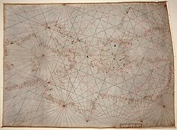
Газрын зургууд болон төрөл бүрийн атласыг зохиож бүтээх тухай шинжлэх ухааныг Зурагзүй буюу дэлхийн олон орны хэлээр Картографи (Англи: Cartography) гэж нэрлэдэг. Орчин үеийн зурагзүйн шинжлэх ухаан нь байгаль орчин, юмс үзэгдлийг үнэн зөвөөр дүрслэх онцгой арга болох газрын зургийн мөн чанар, түүнийг зохион бүтээж, хэвлэх болон ашиглах арга барилыг судална.
Ном зүй
- Belyea, B. 1992. Amerindian Maps: the Explorer as Translator. Journal of Historical Geography 18, no.3 :267-277.
- Bender, B. 1999. Subverting the Western Gaze: mapping alternative worlds. In The Archaeology and Anthropology of Landscape: Shaping your landscape (eds) P.J. Ucko & R. Layton. London: Routledge.
- Crawford, P.V. 1973. The perception of graduated squares as cartographic symbols. Cartographic Journal 10, no.2:85-88.
- J. B. Harley and David Woodward (eds) (1987). The History of Cartography Volume 1: Cartography in Prehistoric, Ancient, and Medieval Europe and the Mediterranean. Chicago and London: University of Chicago Press. ISBN 0-226-31633-5.
{{cite book}}:|author=has generic name (help) - J. B. Harley and David Woodward (eds) (1992). The History of Cartography Volume 2, Book 1: Cartography in the Traditional Islamic and South Asian Societies. Chicago and London: University of Chicago Press. ISBN 0-226-31635-1.
{{cite book}}:|author=has generic name (help) - J. B. Harley and David Woodward (eds) (1994). The History of Cartography Volume 2, Book 2: Cartography in the Traditional East and Southeast Asian Societies. Chicago and London: University of Chicago Press. ISBN 0-226-31637-8.
{{cite book}}:|author=has generic name (help) - J. B. Harley and David Woodward (eds) (1998). The History of Cartography Volume 2, Book 3: Cartography in the Traditional African, American, Arctic, Australian, and Pacific Societies. [Full text of the Introduction by David Woodward and G. Malcolm Lewis]. Chicago and London: University of Chicago Press. ISBN 0-226-90728-7.
{{cite book}}:|author=has generic name (help) - J. B. Harley and David Woodward (eds) (2005). The History of Cartography Volume 3 (in press, 2005): Cartography in the European Renaissance. Chicago and London: University of Chicago Press. ISBN 0-226-90733-3.
{{cite book}}:|author=has generic name (help) - J. B. Harley and David Woodward (eds) (1987). The History of Cartography Volume 4 (edited by D. Graham Burnett, Matthew Edney, and Mary G. Sponberg Pedley with Founding Editor David Woodward): Cartography in the European Enlightenment. Chicago and London: University of Chicago Press. ISBN 0-226-31633-5.
{{cite book}}:|author=has generic name (help) - J. B. Harley and David Woodward (eds). The History of Cartography Volume 5: Cartography in the Nineteenth Century. Chicago and London: University of Chicago Press. ISBN.
{{cite book}}:|author=has generic name (help) - J. B. Harley and David Woodward (eds). The History of Cartography Volume 4: Cartography in the Twentieth Century. Chicago and London: University of Chicago Press. ISBN.
{{cite book}}:|author=has generic name (help) - MacEachren, A.M. (1994). Some Truth with Maps: A Primer on Symbolization & Design. University Park: The Pennsylvania State University. ISBN.
- Monmonier, Mark (1991). How to Lie with Maps. Chicago: University of Chicago Press. ISBN 0-226-53421-9.
- Monmonier, Mark (1993). Mapping It Out. Chicago: University of Chicago Press. ISBN.
- ESRI. 2004. ESRI Cartography: Capabilities and Trends. Redlands, CA. White Paper
- Harvard Graduate School of Design, 2005. http://www.gsd.harvard.edu/gis/manual/style/index.htm
- Jeer, S. 1997. Traditional Color Coding for Land Uses. American Planning Association. pp. 4–5
- Kent, A.J. 2005. "Aesthetics: A Lost Cause in Cartographic Theory?" The Cartographic Journal 42(2) pp.182–188
- Kraak, Menno-Jan and Ormeling, Ferjan (2002). Cartography: Visualization of Spatial Data. Prentice Hall. ISBN 0-130-88890-7.
{{cite book}}: CS1 maint: multiple names: authors list (link) - Lewi, P.J. (2006). Speaking of Graphics.
- Imus, D. and Dunlavey, P. 2002. Back to the Drawing Board: Cartography vs the Digital Workflow. MT. Hood, Oregon.
- Oliver, J. 2007. The Paradox of Progress: Land Survey and the Making of Agrarian Society in Colonial British Columbia. In Contemporary and Historical Archaeology in Theory (eds) L. McAtackney, M. Palus & A. Piccini, pp. 31–38. Oxford: BAR, International Series 1677
- Olson, Judy M. 1975. Experience and the improvement of cartographic communication. Cartographic Journal 12, no. 2:94-108
- Peterson, Michael P. (1995). Interactive and Animated Cartography. Upper Saddle River, New Jersey: Prentice Hall. ISBN 978-0130791047.
- Phillips, R., De Lucia, A., and Skelton, A. 1975. Some Objective Tests of the Legibility of Relief Maps. The Cartographic Journal. 12, pp. 39–46
- Phillips, R. 1980. A Comparison of Color and Visual Texture as Codes for use as Area Symbols on Relief Maps. Ergonomics. 23, pp. 1117–1128.
- Pickles, John (2003). A History of Spaces: Cartographic Reason, Mapping, and the Geo-Coded World. Taylor & Francis. ISBN 0-415-14497-3.
- Rice, M., Jacobson, R., Jones. D. 2003. Object Size Discrimination and Non-visual Cartographic Symbolization. CA. pp. 1–12.
- Slocum, T. (2003). Thematic Cartography and Geographic Visualization. Upper Saddle River, New Jersey: Prentice Hall. ISBN 0-130-35123-7.
- Wilford, John Noble (2000). The Mapmakers. Vintage Books. ISBN 0-375-70850-2.
- "Map Imitations" in Detecting the Truth: Fakes, Forgeries and Trickery, a virtual museum exhibition at Library and Archives Canada
- Sircar, D.C.C. (January 1990). Studies in the Geography of Ancient and Medieval India. Motilal Banarsidass Publishers. ISBN 8120806905.
- Wood, Denis, The Power of Maps, New York/London, The Guilford Press, 1992
