
Файл:Mapa Geografico de America Meridional (1790).jpg
Үзлэгийн хэмжээ : 424 × 599 пиксел Бусад зургын нягтрал: 170 × 240 пиксел | 339 × 480 пиксел | 543 × 768 пиксел | 1,059 × 1,497 пиксел.
Эх файл (1,059 × 1,497 пиксел, файлын хэмжээ: 558 КБ, MIME төрөл: image/jpeg)
Товч агуулга
| Тайлбар |
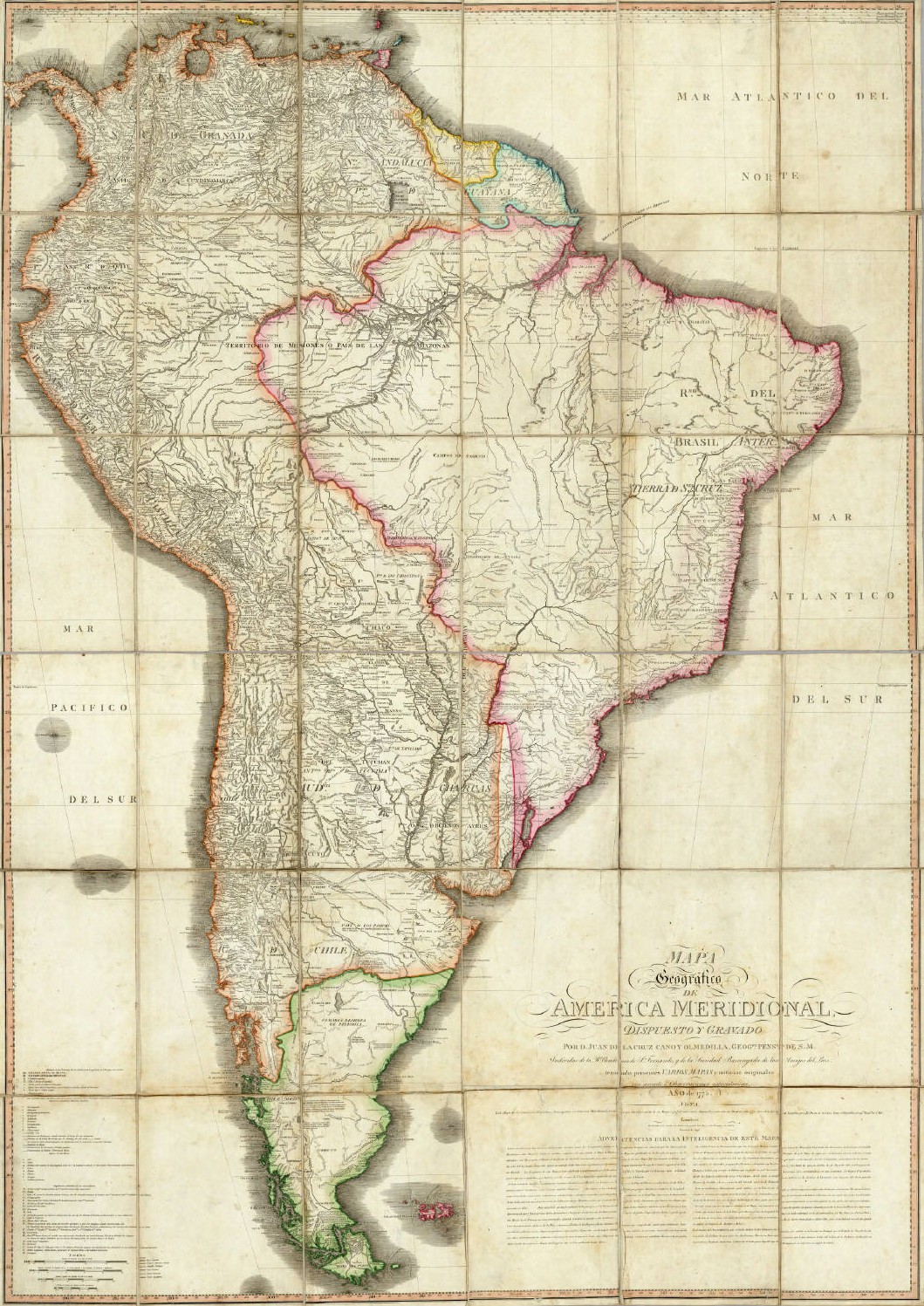
English: Geographical Map of South America, Drawn and Engraved by Mr. Juan de la Cruz Cano y Olmedilla, Geographer to His Majesty...
Español: Mapa Geografico de America Meridional, dispuesto y gravado por D. Juan de la Cruz Cano y Olmedilla, Geogfo. Pensdo. de S. M. Individuo de la R. Academia de Sn. Fernando, y da la Sociedad Bascongada de los Amigos del Pais, teniendo presentes Varios Mapas y noticias originales con arreglo a Observaciones astronómicas (Año 1775.) Londres, Publicado por William Faden, Geografo del Rey, y del Principe de Gales, Enero 1 de 1799. |
||||||||||||||||||||||
| Огноо | 1775, reprinted 1799 | ||||||||||||||||||||||
| Эх үүсвэр | Unknown source | ||||||||||||||||||||||
| Зохиогч |
|
||||||||||||||||||||||
| Other versions |
|
||||||||||||||||||||||
.jpg)
.jpg)
Лиценз
|
This is a faithful photographic reproduction of a two-dimensional, public domain work of art. The work of art itself is in the public domain for the following reason:
The official position taken by the Wikimedia Foundation is that "faithful reproductions of two-dimensional public domain works of art are public domain".
This photographic reproduction is therefore also considered to be in the public domain in the United States. In other jurisdictions, re-use of this content may be restricted; see Reuse of PD-Art photographs for details. | ||||
Файлын түүх
Огноо/цаг дээр дарж тухайн үеийнх нь файлын байдлыг харна уу.
| Огноо/Цаг | Жижиг зураг | Хэмжээ | Хэрэглэгч | Тайлбар | |
|---|---|---|---|---|---|
| одоогийн | 02:37, 14 Тавдугаар сар 2006 | | 1,059 × 1,497 (558 КБ) | Fbaltra | |
| 02:32, 14 Тавдугаар сар 2006 |  | 1,097 × 1,536 (360 КБ) | Fbaltra | == Summary == Mapa Geografico de America Meridional de Juan de la Cruz Cano y Olmedilla, 1790. Publicado en 1799 por William Faden, Londres. == Licensing == {{PD-Art}} Category:Historical maps of South America Category:Historical maps of Chile |
Холбоос
Энэ файлд холбоос хийсэн хуудас байхгүй байна.
Файлын хэрэглээ (бүх төсөл)
Дараах бусад вики энэ файлыг ашигладаг:
- de.wikipedia.org дахь хэрэглээ
- en.wikipedia.org дахь хэрэглээ
- es.wikipedia.org дахь хэрэглээ
- it.wikipedia.org дахь хэрэглээ
- roa-tara.wikipedia.org дахь хэрэглээ
.jpg)